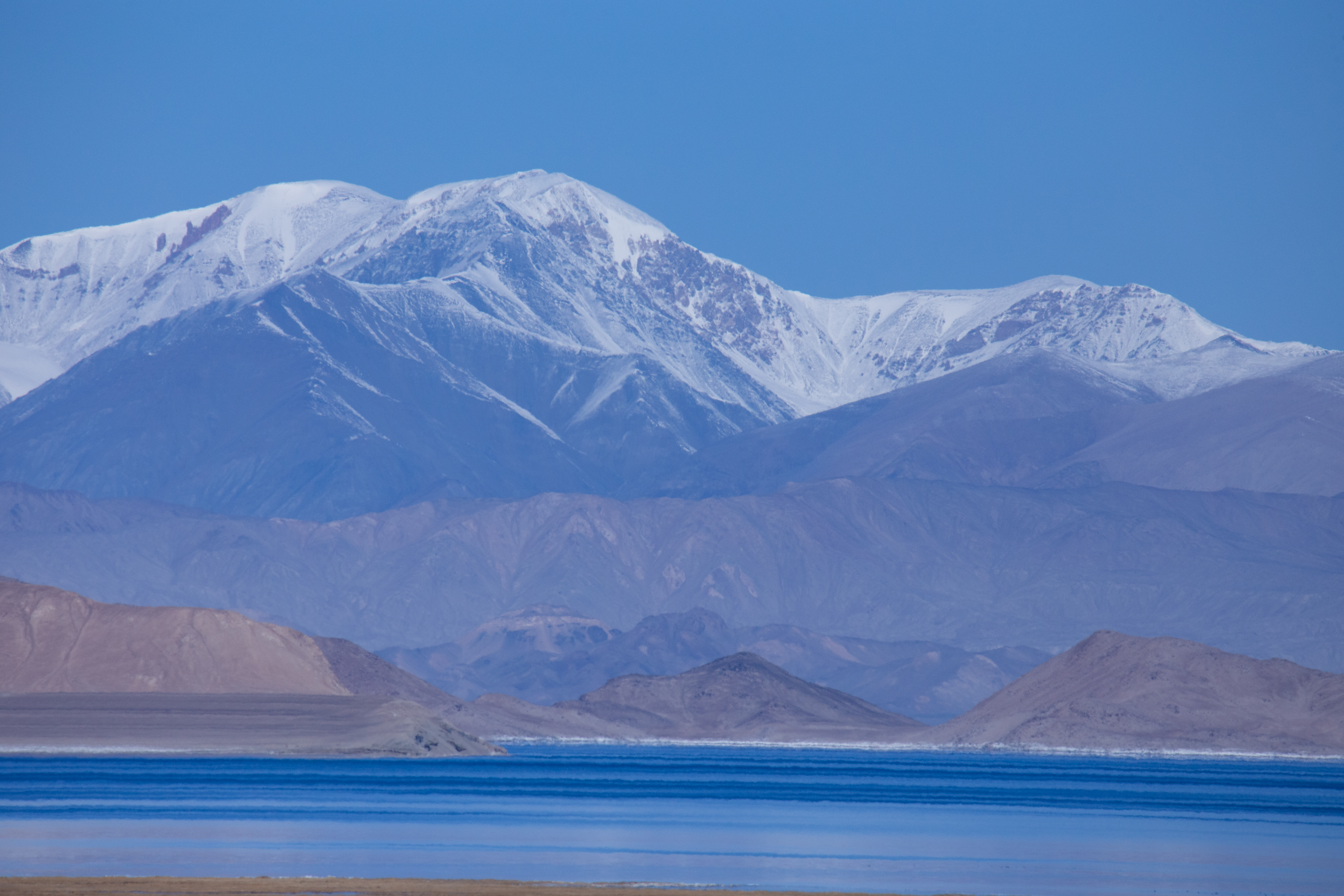


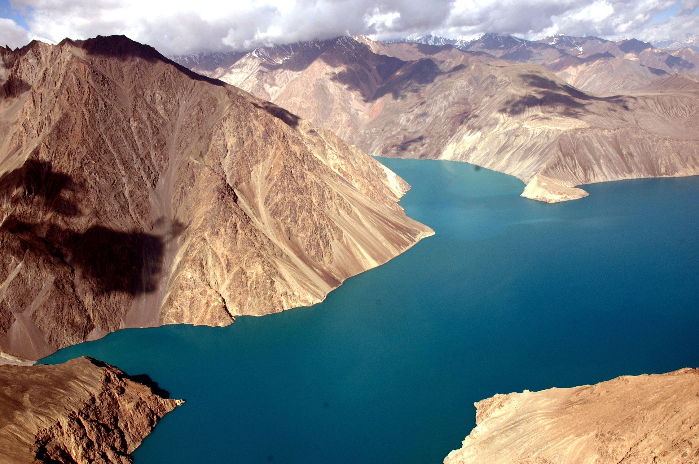
Known as a sleeping dragon or a piece of blue jewellery -the famous Sarez Lake is located in between Eastern and Western Pamirs, the Rushon district of the GBAO. The length of the lake is 55.8 km. It is an absolute surface height of 3,263 m: maximum width of 3.3 km, and a maximum depth of 500 m. The name of the lake comes from the village of Sarez which the population migrated to the different parts of the GBAO, to other villages in Bartang valley, and in Ghund valley.
History of the lake
In February 1911 a powerful earthquake destroyed the beautiful and agriculturally rich village of Usoi in the Eastern Pamir. The Usoi dam was formed out of huge rockfalls that blocked the flow of the Murghob river. The village Usoi with 302 population was buried under the debris of the rocks, and by October 1911 the lake swallowed the village of Sarez. Its population migrated to other villages in Bartang, and to Ghund valley in present Shughnon district. Over the years the level of the water and the length of the lake increased.
Legend about lake Sarez
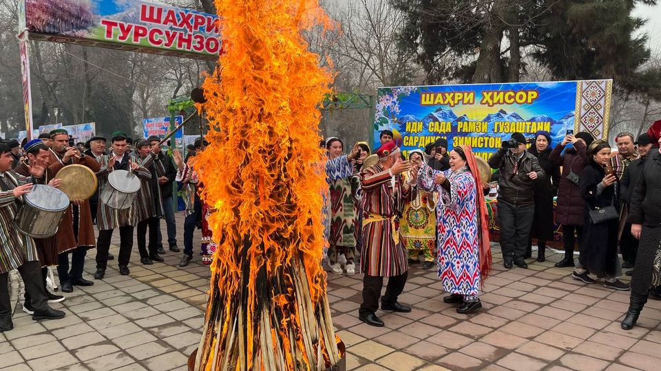
According to the legend the people of Usoi lived in luxury and had bad manners. They were not God fearing and therefore were punished by an earthquake. These myth about the Sarez, and the appearance of other lake in Pamir are similar in content, but they remind people to maintain integrity, hospitality, belief and live-in harmony and peace with nature in the hazardous mountainous areas.
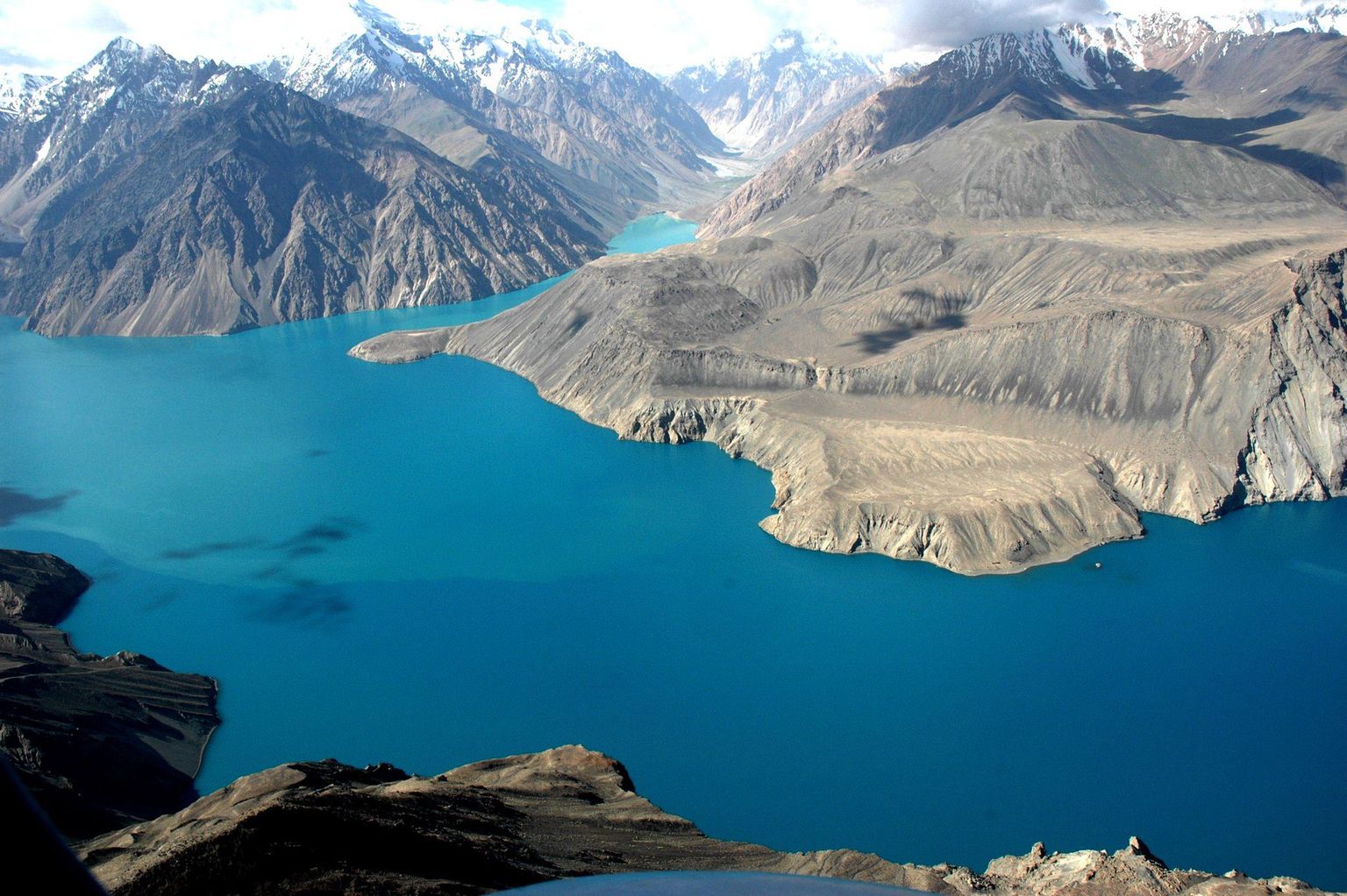
Several mysteries are making Sarez lake attractive to both, scholars and visitors. Russian and other European explorers visiting Sarez before 1911, reported that there was a lively village with several households, which economy was maintained by animal husbandry and farming. In the Soviet period, a systematic investigation of the lake was conducted with a huge investment from Moscow. In post-Soviet Tajikistan, miscellaneous data were accumulated about its potential hazards, such as the gigantic flood caused by right bank landslide. The magnificent and unusual landscapes like theatrical scenery, combined with the dramatic history of its origin, its hazard, incredibly intrigues travellers. Thousands of tourists from all over the world come to this inaccessible region of Central Asia to see the famous lake, considered the blue pearl of the Pamirs.
Gallery


Travelling to the Site
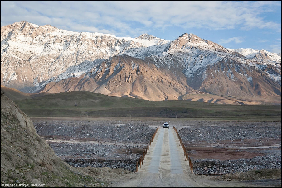
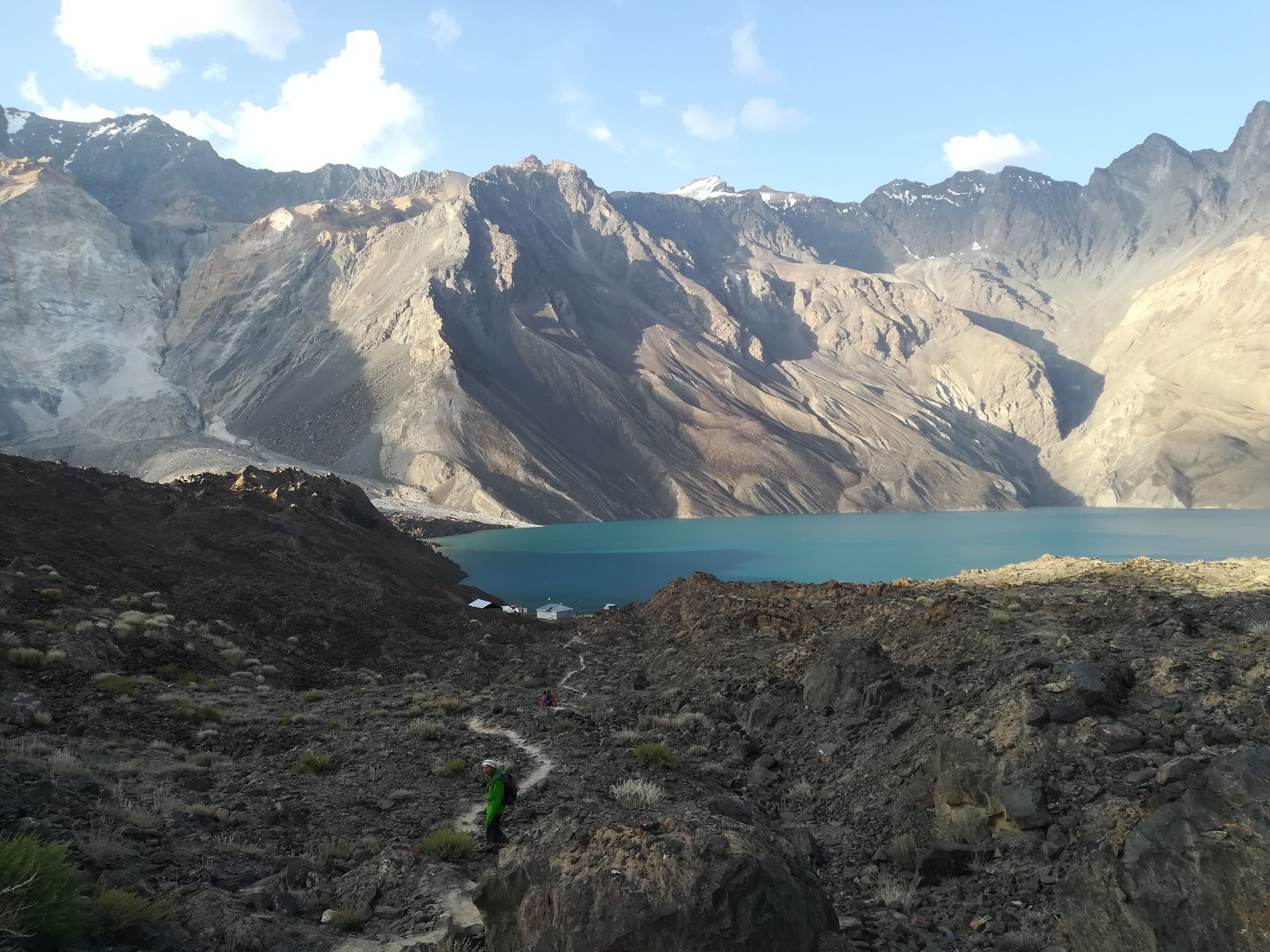
Few routes are leading to Sarez lake. The first and most popular route starts from Barchidev village in Upper Bartang valley, located 200 km from Khorog and 140 km from Rushon district centre. The car road goes until village Barchidif and from there a trek can be taken to the lake. Normally it takes 9-10 hours to trek to reach Sarez. The trek goes along the Murgob River and reaches the vast, natural Usoi dam.
Underneath this dam, the beautiful village was buried in 1911. Visitors can continue trekking, hiking around the lake to Irkht, where the meteorological station is located. They can also use the boat to cross the Sarez lake or stay at night camping at the shore of the lake. They can also continue trek further up along Langar river to Wukhinch (name of the pasture) and pass long the Uchkul (three lakes) and over Langar pass or Chapdarkul lake and reach at the Bulunkul or Bachor the villages of Shughnon district.
The second hiking or climbing route to Sarez can be taken by lovers of adventure and trekkers from Bulunkul, Bachor or Bardara villages. The routes from these destination merge in Wukhinch (name of the pasture) and from there it descends to Irkht and Sarez lake (shown on the map with blue. The third and very least taken route comes from the Murghob side along the river Murghob that leads to Sarez.